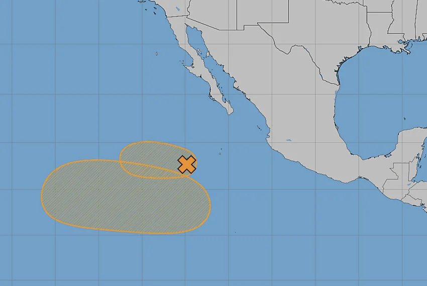
Mexico’s National Meteorological Service (SMN) is currently tracking two weather systems in the Pacific Ocean, raising important concerns for the safety and daily lives of citizens. As of Wednesday morning, Tropical Wave 8 was identified 760 kilometers southwest of Cabo San Lucas in Baja California Sur, moving west-northwest at speeds of 24 to 32 km/h. It holds a 50% probability of cyclonic development within the next 48 hours, which could lead to increased winds and potentially severe weather in affected areas. The National Water Commission (Conagua) also noted the presence of a second low-pressure area forming nearby, with a heightened probability of 60% for development within a week. Both systems are positioned over warm waters, creating conditions that could encourage their intensification.
Should these systems develop into tropical storms, they would be named Douglas and Elida, based on the official 2026 season list. The SMN is closely monitoring the situation as the storms’ proximity could lead to a phenomenon known as the Fujiwhara Effect, which occurs when two tropical systems interact closely. This rare occurrence may cause one storm to absorb the other or for both to orbit around a central point, complicating forecasts for hurricane trajectories. The unpredictability of such interactions adds a layer of urgency to the monitoring efforts.
As this weather situation unfolds, it is vital for residents along the coasts to stay informed and prepared. Monitoring updates from the SMN and the Government of Mexico is crucial for safety, especially in light of the potential for strong winds and severe weather conditions.