

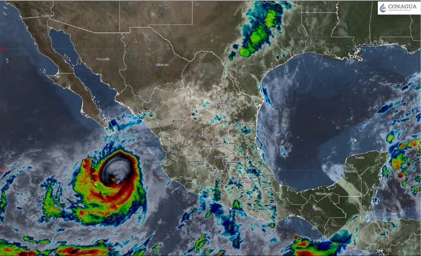
Hurricane Rachel is rapidly intensifying in the Pacific, now classified as a Category 3 storm with sustained winds of up to 195 km/h. As it approaches, it is raising concerns about severe weather conditions that could significantly impact daily life along the coasts of Nayarit, Sinaloa, and southern Baja California Sur. The National Meteorological Service warns of heavy rainfall, with accumulations potentially reaching 75 mm. This persistent rain raises the risk of landslides, river flooding, and other dangerous conditions.
Currently, Rachel is positioned about 415 km east-southeast of Cabo Corrientes, Jalisco, and is moving west at 6 km/h. Although the hurricane may reach Category 4 status, projections indicate that it is unlikely to make landfall in Mexico. However, local authorities are on high alert, particularly in Michoacán, Colima, and Jalisco. Although schools in Jalisco had reopened after brief closures, ongoing assessments suggest continued vigilance is essential.
At the same time, the first cold front of the 2026-2027 season is contributing to unpredictable weather patterns across northern and central states. As this cold front moves south, temperatures are expected to drop, accompanied by strong winds and heavy rain. States like Coahuila, Nuevo León, Tamaulipas, San Luis Potosí, and others could see rainfall between 75 to 150 mm, with gusts reaching 60-70 km/h.
State and federal agencies, including the National Civil Protection Coordination, urge residents to stay informed on weather developments and take necessary precautions. This multifaceted weather situation underscores the importance of community awareness and preparation as these storms unfold.